
Sea-Level Rise in the Past
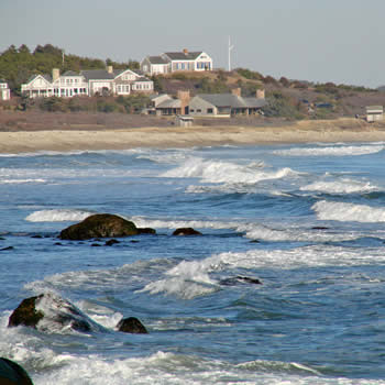
Sea level has been rising in our area since the retreat of continental glaciation some 20,000 years ago when the mile-thick ice mass, which also formed the hills and plains of Martha’s Vineyard, melted. In the past century, the dramatic escalation in air and water temperature due to climate change has brought about greatly accelerated sea level rise. The average worldwide sea level has risen about 8 inches since 1880. Historic sea level monitoring data from Woods Hole since 1932 indicates sea-level rise of 2.8 mm per year and from Nantucket since 1965 indicates a rise of 3.5 mm per year (65% and 76% respectively more than the world-wide trend).
Projecting the Amount of Sea-Level Rise on Martha's Vineyard
-
Expansion of the ocean waters due to rising temperatures,
-
Melting of ice, notably glaciers and possibly the Western Antarctic and the Greenland ice sheets,
-
Changes in ocean currents, notably the Gulf Stream that would especially affect the U.S. Northeast.
According to the IPCC, the average sea level is projected to rise between 12 and 48 inches by 2050 and 12 and 72 inches by 2100. To this worldwide rise is the relative impact of subsidence in those parts of the world, such as Martha’s Vineyard, which are cooler and are sinking deeper into the Earth’s crust. Some scientists, such as oceanographer and climatologist Stefan Rahmstorf, argue that even these estimates are low because they don’t sufficiently account for the increase in water temperature and the resulting expansion of the ocean.
The Need for a Multi-Factor Dynamic Model: A so-called “bathtub model” gives a rough portrait of potential impacts assuming a simple rise in sea level with all other factors remaining the same. Although the bathtub model gives a good first approximation of possible impacts, it would be desirable in the future to use a sophisticated multi-factor model to better predict the likely impacts. Such a hybrid model would combine the impacts of sea-level rise with the other factors causing coastal erosion, as well as the shape and geology of the affected land areas. The result would provide a plausible estimation of the lateral position of the shoreline after erosion and sea level rise. To adequately address vulnerability, the impacts of coastal flooding (as from a Nor’easter) and storm surge (from a hurricane) should also be modeled. That result would identify vulnerability under storm conditions, a more realistic estimation of the likelihood of inundation under less than ideal conditions. The Woods Hole Group developed a model dealing with most of these factors, and has been hired by the Town of Oak Bluffs to do more sophisticated projections of sea-level rise in Oak Bluffs. It would be desirable to complete similar modelling for the whole Island in the next few years.
Impacts of Sea-Level Rise on Various Resources
Sea-level rise will impact a number of resources.
- Critical Infrastructure: Critical facilities are those without which loss of life, safety, or economic viability would ensue. The Hazard Mitigation Plan identified all such vulnerable facilities by town. They are mapped and there are listings including dollar valuations [hot link to vulnerability matrix to be added] It has also been placed in the shared\communications\website folder). Much of the critical infrastructure vulnerable to sea level rise consists of water-dependent facilities, such as ferry terminals, that need to be at the waterfront in order to function. The planning for them will be very different from planning for facilities that could reasonably be relocated landward.
- Roads: The rising sea levels are projected to affect many of the roads along the coast and ponds. Our three major downtown areas are also highly vulnerable to rising in sea levels because of their proximity of the ocean and the low elevation. Some roads are critical facilities due to emergency access in case of events such as hurricanes. The Commisison has prepared maps showing the roads that will be affected by sea-level rise over time. Strategies for roads include abandonment, elevation, or relocation, none of which promises to be an easy fix at any of the vulnerable locations. It is important to open up the dialog regarding the outcomes for some of these roads without good long-term prognoses. Vulnerable Roads
- Buildings and Property: The Hazard Mitigation Plan identified persons and property vulnerable to sea level rise, by town with maps and tables, by town, identifying vulnerable persons and property, with valuations, for both the present and future scenarios (at buildout).
Documents
-
Visualizing Sea-Level Rise (video): In order to illustrate the impacts of sea level rise, the MVC prepared a series of maps showing what the impact might be on the Island, and visual simulations showing what this could look like in a number of critical locations. These illustrations use an estimate of 1.5 feet by 2050 and 5.0 feet by 2100, representing a plausible sea-level rise scenario, corresponding roughly to Rahmstorf’s moderate-emissions scenario that assumes no significant decrease in the global production of greenhouse gases, along with at least 4.4” per century added to account for land subsidence.
-
Global Sea Level Linked to Global Temperature: This 2009 paper (Vermeer and Rahmstorf), explains sea level rise projection based on water temperature.
-
Comparing Climate Projections to Observations Up to 2011: This 2012 paper (Rahmstorf et al), explains sea level rise projection based on water temperature.